
Mountain Biking--Vail Valley Intermediate Trails
Intermediate Trails
Shrine Pass to Red Cliff: 11.3 miles. The ride begins on Shrine Pass road. Look for a sign just west of the Vail Pass rest area directing riders to Red Cliff. Ride west on the road over Shrine Pass (11,089 feet). The descent into Red Cliff is pretty straight forward as the route parallels Turkey Creek. Two cars are required for the Shrine Pass to Red Cliff ride. Parking for Red Cliff: Drive west on Interstate 70 to Minturn Exit 171. Go east on U.S. Highway 24 to Red Cliff before the bridge. Shrine Pass Road is the first left from the Red Cliff turn-off. Parking is available along the side of the road. Parking for Shrine Pass: Drive Interstate 70 east to Vail Pass. Use Exit 190 and park at the Vail Pass Rest Area.
Vail Pass: 22.2 miles. The Vail Pass ride begins along the frontage road next to the Vail parking structure. Ride east along the frontage road en route to East Vail. After crossing under the interstate at the East Vail exit, the road merges with Bighorn Road. From here, continue riding toward Gore Creek campground. There is a gate here and the road beyond is closed to car traffic. The road climbs steadily to the intersection with the Vail Pass bike path. Turn right onto the path and ride downhill briefly. The route will then cross Polk Creek and then make a sharp left turn under the interstate. There is one short steep climb from here and then the route climbs steadily to Vail Pass. The grade eases as riders near the top of the pass and go by Black Lakes. From here, riders can continue a short distance to the rest area at the top of Vail Pass. Descend the same route. Drive on Interstate 70 to Exit 176 Vail. Parking is available at the Lionshead parking structure.
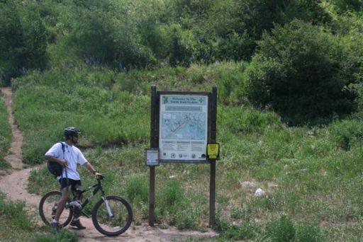
North Trail: 6.5 miles. This version of the North Trail begins at the Red Sandstone trailhead on Red Sandstone Rd. From the trailhead, ride west above Vail up countless switchbacks. After 2.0 miles riders will come to an intersection with Buffehr Creek trail. Stay left and continue down a loose and rocky descent. Reaching the bottom, riders will cross Buffehr Creek and traverse around some beaver ponds to an intersection. Follow the signs to continue on the North Trail. The trail begins to climb again with more switchbacks and great views of the Gore and Sawatch Ranges. Eventually, the trail will start to contour and the ride becomes quite enjoyable as it passes through lush aspen groves. In the height of summer, the wildflowers through this section are very impressive. The trail will start to descend towards the Davos trailhead. Stay on the main trail and ride to an intersection with the Davos Hill Climb. Turn right and ride the dirt road (FS 781) 0.42 miles to a gate. Go through the gate to access the last single-track section of the ride. Descend through the trees to the Trappers Run trailhead. From here, ride the North Frontage Road all the way back to Red Sandstone Rd and the start of the ride. Drive west on Interstate 70 to Exit 173 West Vail. Take the roundabout east past Safeway and City Market to Red Sandstone Rd. Turn left and drive 0.35 miles to the Red Sandstone trailhead.
Son of Middle Creek: 6.5 miles. Start from the Red Sandstone Trailhead and ride about 3.0 miles to the junction of FS 700 and FS 786. Turn right on FS 786 and ride 0.15 miles to the start of The Son of Middle Creek Trail (FS #2136). The trail begins with a slight climb before it descends into the first creek crossing. The trail then climbs from the creek and contours before heading into a second creek crossing. The trail then continues on through pine forest and aspen groves. After another 1.5 miles, riders will come to an intersection. From here, there are two options to continue. Option 1 (2.0 miles): The trail that continues left will be more technical than option two, taking riders through rocky sections and switchbacks. As the trail descends towards Vail it will travel through a large meadow and then cross a bridge over Middle Creek. Turn right after the bridge and continue down to Middle Creek Trailhead. Return to the start by riding 2.9 miles on North Frontage Rd. Turn right on Red Sandstone Rd and ride 0.35 miles back to the Red Sandstone Trailhead. Option 2 (2.0 miles): Riders who turn right will descend an easier route along a newer section of single-track. This route has a few switchbacks and will exit on to Red Sandstone Road (FS 700). Turn left and ride about 1.0 mile back to Red Sandstone Trailhead. Directions: Drive west on Interstate 70 to Exit 176 Vail. Head west on North Frontage Road and turn right on Red Sandstone Road. Drive 0.35 to the Red Sandstone Trailhead. Parking is available here.
Lost Lake Loop: 12.7 miles. The Lost Lake trail begins on FS 700 at the Lost Lake trailhead. Ride about 4 miles to the intersection of FS 700 and FS 786. Stay left at each of the road junctions along the way. Turn left on to FS 786 and ride 3.75 miles to the start of the Lost Lake single-track (FS 1893). At this point, exit the road and start riding downhill immediately. The first part of the trail will go through the trees and across a marshy area. Within a mile Lost Lake will come into view. Navigation can be tricky through this section due to fallen trees and large rocks. Continue to follow the trail counter-clockwise around the lake. After a short climb on rocky terrain, the trail continues away from the lake to the southwest. From here ride 3.2 miles back to the Lost Lake trailhead through a combination of dense forest and open meadows. Directions: Drive west on Interstate 70 to Exit 176 Vail. Head west on North Frontage Road and turn right on Red Sandstone Road, FS 700. Drive 3.25 miles to the junction of FS 700 and FS 786. Stay left and continue 3.8 miles on FS 700 to the Lost Lake trailhead. Parking is available here.
Piney Lake: 26.2 miles. The Piney Lake out-and-back bike ride begins on a paved bikeway to Red Sandstone Road. The road climbs slowly within the first 2 miles on a well-maintained road but at times can be washboarded and dusty. At about 4.8 miles, the ride will ascent and riders will veer left passed the Lost Lake motorized trail before heading downhill parallel to Indian Creek. The road will ascent briefly for a little over a mile. The road tapers off, passing over Indian Creek and climbs again. At about 8.6 miles, riders will continue passed Piney Road and the Lost Lake hiking trail. There, the road levels off and descends about 2.4 miles. Riders will turn right at the sign for Piney Ranch. The road runs along the Piney River for less than 2 miles to the lake. Directions: The ride begins on the West Vail Bikeway next to the West Vail shopping center north of Interstate 70, West Vail Exit 173. Climb 1.4 miles east on the paved bikeway to Red Sandstone Road. Turn left at the Piney Lake sign and onto a dirt pathway of Red Sandstone Road.
Davos Hill Climb: 8.4 miles. Davos is a short ride with constant elevation gain. The 3.3 mile route follows FS Road 781 that will be rocky and rutted in sections. The route passes through aspen glens and open meadows with views of Down Junction. The ride ends at a radio tower with views of Mt of the Holy Cross and Meadow Mountain in the distance. Descend the same route. Directions: Drive west on Interstate 70 to Exit 173 West Vail. Take a right through roundabout park in the West Vail Shopping Center. Ride west on N Frontage Rd and turn right on Chamonix Road. Turn right on Arosa Drive and then Cortina Lane. Continue on as the road turns to dirt.
Berry Creek: From the parking area, start riding east on Berry Creek Rd. The road will bend north toward the Berry Creek drainage after about 0.30 miles. Continue riding uphill for another 0.75 miles to an intersection. Turn left here and climb steeply 0.40 miles to the ridge. Stay right and continue riding steadily uphill. This section will make a sweeping left turn towards the west. After about 0.80 miles, look for a faint doubletrack on the left. Turn here and ride through a grassy meadow. After 0.5 miles the descent into Endo Alley begins. Take care through this section, as the downhill can be rutted and loose. From the bottom, the route climbs back to the ridge. Turn right at the top and continue down the steep and loose doubletrack back to the trailhead and the beginning of the ride. Directions: Drive Interstate 70 west to Exit 163 Edwards. Turn right on Beard Creek Rd and drive 0.35 miles to Moonridge Drive. Parking is available at the trailhead.
return to Mountain Biking Overview