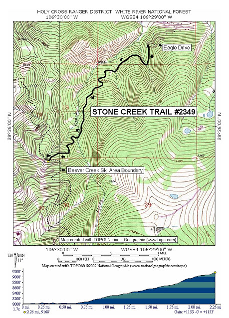
Stone Creek Trail #2349


Length: 2.3 miles (one way)                     Trail Use: Moderate

Difficulty: Moderate                                    Open To: XC Skiing, Snowshoe

Beginning Elevation: 8,015 feet              Ending Elevation: 9,168 feet

Elevation Gain: +1,153 feet                      USGS Map(s): Minturn


Access from Vail : Travel west on I-70 to Exit 171 for Minturn, Leadville, and Hwy 6/24. Exit here and turn left on Hwy 6. Continue approximately 2.5 miles to Eagle Road, just after passing under I-70. Turn left at the light and continue to Eagle Drive. Turn right at this stop sign and drive past the golf course and wind your way up to the cul-de-sac where the trail begins.

Trail Highlights: From the trailhead, the trail is very flat for the first .75 miles until a fork. The trail right leads down onto the golf course. Turns left here and remember this intersection for your return trip so you don’t end up down on the golf course. The trail now climbs along the creek. After a while, there will be many forks to describe here. Many were created by skiers and snowboarders skiing down from Beaver Creek. Beware of possible downhill traffic near the end of the ski day.
 

Questions? Just Ask!

By giving us your phone number and email address, you are giving Susan Rollins permission to contact you via email, phone, or text.