
GROUSE MOUNTAIN TRAIL #2010
Length:
15.6 miles
Trail Use: Light to Moderate
Difficulty:
More Difficult
Open To: Hiking, Horseback
Beginning Elevation:
7,834 ft.
Ending Elevation: 8,514 ft.
Elevation Gain:
+680 ft.
USGS Map(s): Minturn, Grouse Mtn
Access #1: North Trailhead
:
Begin at the Grouse Creek Trailhead 1 mile north of Minturn on U.S. Hwy. 24. Hike the West Grouse Creek Trail 7 miles to the junction with Grouse Mountain Trail.
Access #2: South Trailhead
:
Begin at the Cross Creek Trailhead on
Tigiwon Road #707. Hike the Cross Creek Trail #2006 six miles to the junction with Grouse Mountain Trail.
Trail Highlights
:
This trail links the West Grouse Creek Trail #2129 and the Cross Creek Trail #2006. The mileages and elevation gains given on this sheet assume hiking from West Grouse Creek trailhead to Cross Creek trailhead. Access to
Grouse
Mountain ,
Buffalo
Lake is provided by this trail. The climb from
Cross
Creek
Valley to the junction of Sisters Cabin Trail #2128 is very steep, but provides good vistas of Mount of the Holy Cross and
Cross
Creek
Valley . Elk and deer are often sighted along this trail. If the trail is hiked north to south, the steep climb out of
Cross
Creek
Valley can be avoided. This trail passes over an eastern shoulder of
Grouse
Mountain and several panoramas of the Sawatch
Range can be seen from openings in the forest and near timberline areas along the trail.
Buffalo
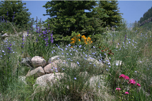
Lake and the surrounding woods and meadows are good places to spot wildlife. Wildflower displays are continuous during the growing season. A side trip to the top of
Grouse
Mountain provides 360 degrees views of the
Gore
Range to the east, the Sawatch Range and the upper
Eagle
Valley .