
Lifes Adventures
UPPER PINEY RIVER TRAIL #1885
Length:
6.68 miles (one way)
Trail Use: Moderate to High
Difficulty:
Easy to More Difficult
Open To: Hiking, Horseback
Beginning Elevation:
9,397 ft.
Ending Elevation: 11,102 ft.
Elevation Gain:
+1,705 ft.
USGS Map(s): Vail West, Vail East
Access from Vail
:
From I-70, take Exit 176 for Vail. Take the
North Frontage Road west to
Red Sandstone Road . Turn here and follow the paved road about 2.5 miles to a fork with a dirt road on the left. There should be a Forest Service sign indicating this is
Red Sandstone Road #700. Continue up this road about 9 miles to
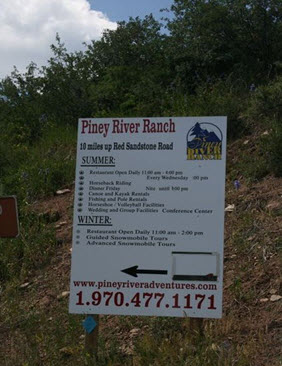
Piney
Lake . There is Forest Service parking on the right before the entrance to Piney River Ranch (private property). The trailhead is on the north side (left side of the parking lot as one faces the Piney River Ranch entrance) of the parking lot.
Trail Highlights
:
From the trailhead it is a gradual climb for 2.5 miles to a cascading waterfall which makes a good destination for the average hiker. The trail becomes less distinct after the falls. Continue along the north side of the river. The trail during the first 4 miles transitions from aspen groves to spruce and fir stands. After mile 4, the trail enters a section of alternating meadows and thick forests that offer many good camping opportunities. The trail then crosses the river several times leading to a small lake at mile 5.5. The next 1.2 miles, to
Upper
Piney
Lake , becomes more rigorous because the trail is steep and can be difficult to follow in some places. It is advised that for the last 1.2 miles, it may be advantageous to have a topographic map, as the trail can be difficult to follow.