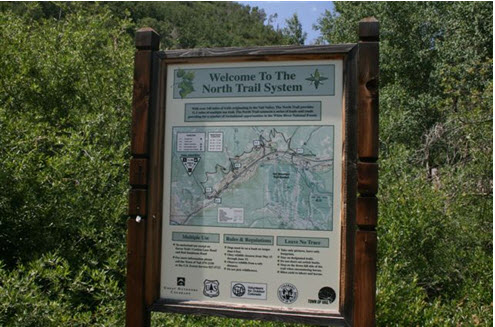
NORTH TRAIL #1896 -
CORTINA LANE
(DAVOS) TO BUFFEHR CREEK
Length:
3.8 miles (one way)
Trail Use: High
Difficulty:
Moderate
Open To: Hiking, Biking, Horseback
Beginning Elevation:
8,212 ft.
Ending Elevation: 8,127 ft.
Elevation Gain:
- 85
ft.
USGS Map(s): Vail West
Access from Vail
: Travel west on I-70 to Exit 173 for West Vail. Proceed north from the roundabout on the north side of I-70. Turn left at the yield sign onto
Chamonix Lane. At Arosa, turn right and veer right onto Davos Trail road. Take the next right on to Cortina, which will take you to the trailhead. There is limited parking at the end of the road.
Trail Highlights
:
Walk 1/8 mile to the Davos singletrack, take the right fork onto Davos singletrack.
After 1 mile, at the signed junction, turn right onto the North Trail. The trail climbs gently and then curves around into a drainage of mixed pine and aspen. The trail continues to climb to the section’s
high point. From here the views to the south and west of Holy Cross Wilderness and the
Gore
Range are excellent. After winding through another drainage, the North Trail begins its descent into Buffehr Creek via a series of switchbacks. At a pile of downed aspens, turn right to continue the descent to Buffehr Creek. Staying straight takes you to Red Sandstone via the Buffehr Creek Singletrack. At the bottom of the descent, turn left onto Garmisch Trail; follow it to the
Buffehr
Creek
Bridge.


