
Lifes Adventures
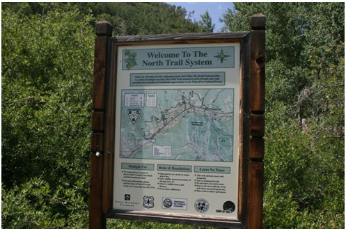
NORTH TRAIL #1896 -
BUFFEHR CREEK TO RED SANDSTONE
Length:
3.2 miles (one way)
Trail Use: High
Difficulty:
Moderate
Open To: Hiking, Biking, Horseback
Beginning Elevation:
8,127 ft.
Ending Elevation: 8,254 ft.
Elevation Gain:
+ 127 ft.
USGS Map(s): Vail West
Access from Vail
: Travel west on I-70 to Exit 173 for West Vail. Turn right and proceed east on the North Frontage Road for 0.5 miles to
Buffehr Creek Road . Turn left and continue to the bridge. There is limited parking at 2 pull-offs just beyond the bridge.
Trail Highlights
:
From the
Buffehr
Creek
Bridge , proceed 1/4 mile on the Garmisch Trail before turning right onto the North Trail. Ascend a series of switchbacks, at the first junction turn right and follow the North Trail to the Buffehr Creek Single-track. After passing a beaver pond on the right and through a pile of avalanche debris, cross Buffehr Creek. From Buffehr Creek, climb steeply for approximately one mile on an open hillside. At the top of the switchbacks, take the right fork onto the North Trail. From here the trail enters an aspen stand; openings along the way provide scenic views to the south and east. Take note of the old lean-to after leaving the back of the drainage. Begin the descent to Red Sandstone via a series of switchbacks where the stand of aspen begins to thin. The first couple switchbacks offer outstanding views of the
Gore
Range and the Red Sandstone drainage.