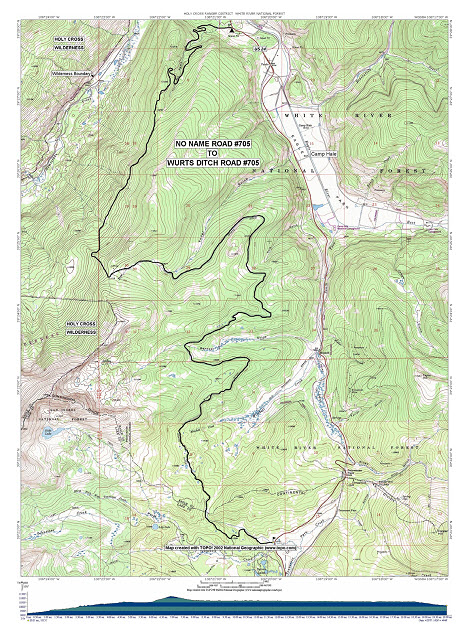
No Name Road #705


Length: 20 miles                                         Trail Use: Light

Difficulty: Easiest                                        Open To: XC, Snowshoe, Snowmobile

Beginning Elevation: 9,207 feet              Ending Elevation: 10,151 feet

Elevation Gain: + 944feet              USGS Map(s): Pando, Mt. Holy Cross


Attractions/Considerations : This trail offers 20 miles of relatively easy riding and outstanding views of the Homestake Valley and the Camp Hale area.

Access from Vail : Travel west on I-70 to Exit 171 for Minturn, Leadville, and Hwy 24. Exit here and turn right (south) onto Hwy 24. Proceed south about 14 miles to the unmarked No Name Road #705 on the right, approximately 1 mile past the Homestake Road #703.

Trail Highlights : This trail starts as the No Name Road then changes names to Wurts Ditch Road at the top of Yoder Gulch. It continues winding south for a total of 20 miles over the Continental Divide and ending up back at Hwy 24.
 

Questions? Just Ask!

By giving us your phone number and email address, you are giving Susan Rollins permission to contact you via email, phone, or text.