Lifes Adventures

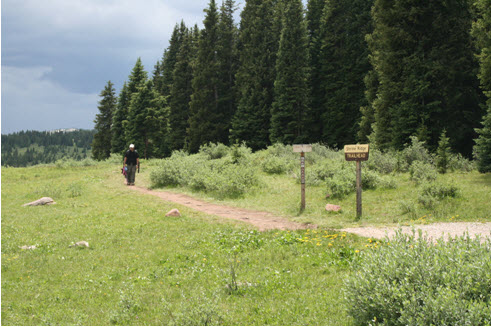
SHRINE MOUNTAIN TRAIL #2016


Length: 2.1 miles (one way)                     Trail Use: Moderate

Difficulty: Easy to Moderate                      Open To: Hiking, Horseback

Beginning Elevation: 11,089 ft.               Ending Elevation: 11,747 ft.

Elevation Gain: +645 ft.                              USGS Map(s): Vail Pass, Redcliff


Access from Vail : Travel east from Vail on I-70 to Exit 190 for Vail Pass. Exit here and turn right, heading west, onto the Shrine Pass dirt road (FSR 712). Follow this easy road 2.3 miles to just past the indistinct Shrine Pass summit and forest boundary. The trailhead is on the left near the gravel driveway for the Shrine Mountain Inn.


Trail Highlights : Follow the trail southwest as it climbs through pine-studded meadows. After about 1.3 miles the trail turns west heading through pine forest before the steepest part of the climb to the saddle to the west of you. From the saddle turn right and travel northwest to Shrine Mountain where you can enjoy spectacular views.


Interesting Information : Named “Shrine” for its excellent view of the Mount of the Holy Cross, the pass was originally a Ute Indian trail and later used by silver miners and settlers. Views from Shrine Mountain include:

North - Gore Range

Northwest - Uneva Peak

Southeast - Copper Mtn ski area

South - Ptarmigan Hill and Ptarmigan Pass

Southwest - Sawatch Range and Mount of the Holy Cross

West - The Flat Top Mountains
 

Questions? Just Ask!

By giving us your phone number and email address, you are giving Susan Rollins permission to contact you via email, phone, or text.